


GPS Map Camera - Timestamp
4.612.00 Reviews
App Specs
- Version
- 1.1.0
- Updated On
- License
- Free
- Downloads
- 5,000,000+
- Developer
- Sliver AI Photo Editor
- Categories
- Photography
- Platform
- Android
Screenshots
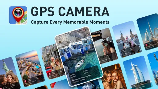
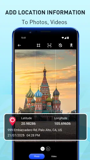
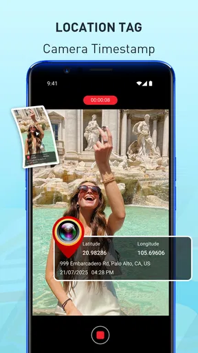
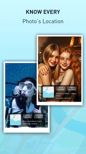
 Analysis by AppCompare
I usually realize a photo needs more context long after I take it: a room I inspected, a trail junction, or a shopfront I meant to revisit. GPS Map Camera - Timestamp is built for that kind of problem. It puts useful place and timing details on images as I capture them, so I don’t have to rely on memory or piece together a day from a camera roll later. That makes it more practical than a general photo editor when the location itself is part of the record.
Start with the reason you need a record
Before opening the camera, it helps to decide what you need the image to prove or remind you of. A travel album may benefit from a visible place and date, while a maintenance record may need a clear view of the subject more than a decorative label. I’d keep the overlay focused: extra text can make a photo harder to read, especially when the important detail is small or near an edge.
A useful everyday example is visiting several properties in one afternoon. I could take a picture of a doorway, a meter, or a feature that needs follow-up, then use the visible location and time to separate it from the other visits. That is more dependable than naming every file immediately, though I would still add a short note or folder name later if the photos need to be handed to a colleague.
Capture first, check the context second
The practical workflow is simple: open the app, frame the subject, and take the picture with the details you want visible. GPS Map Camera - Timestamp focuses on adding location, date, and time context rather than replacing a full editing suite. I’d take a quick test image before starting a long walk or work visit, then check that the stamp is legible and placed where it doesn’t cover the subject.
Location accuracy depends on the phone having a useful position when the image is taken. In a dense city, indoors, or near tall buildings, I’d pause briefly before photographing something that needs a precise location and compare the displayed place with what I know on the ground. If the stamp looks wrong, the safest choice is to retake the photo once the position settles rather than assume the image will be easy to correct later.
Choose what belongs on the image
The app’s appeal is that you can choose which details appear in the watermark. For a quick personal travel record, a location and date may be enough; for documenting a sequence of events, including the time can help establish order. I would avoid adding every available detail by default. A crowded stamp competes with the photograph, and a clean image is often more useful when someone else needs to inspect a small object or read a sign.
That choice also affects how you share the photo. A visible location can be helpful in a trip recap or a work log, but it can reveal where a person lives, works, or spends time. Before posting publicly, I’d review the image and consider whether the place information is appropriate for the audience. For private documentation, keeping the context may be the point; for a public post, a location-free copy may be preferable.
Worth Reading Before You Choose

EA SPORTS FC Mobile 26 Is a Bigger Football Game, but It Takes Time

Flipboard Shows What News Apps Must Do Beyond the Feed

Switching to Android Auto Means Rethinking Your Driving Routine

Google Calendar Makes a Crowded Week Easier to Manage

Ludo King Makes the Most of the Minutes Between Plans

Baby Panda World Brings Quick Play to Modern Phones, but Its Game Library Feels Busy
Why You Need This App
We’ve all been there—scrolling through our camera roll trying to recall exactly where we captured that stunning sunset or quirky street art. GPS Map Camera - Timestamp solves this dilemma by embedding location, date, and time information directly onto your photos. It’s like having a personal travel diary, minus the hassle of jotting down every detail.
Getting Started: Easy Peasy
First things first, downloading and setting up the app is a breeze. Available on both Android and iOS, you can find it on the Google Play Store or the App Store. Once installed, the user interface is intuitive, so you won’t be fumbling around trying to figure out how to get started. Just open the app, and you’re greeted with a straightforward layout, ready for action.
After granting the necessary permissions—because, yes, it needs access to your camera and location—the app is all set to accompany you on your photographic journeys. It’s like having a reliable co-pilot who keeps track of all the details without any nagging.
The Nitty-Gritty: Features Galore
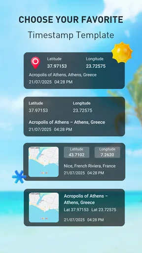
One of my favorite features is the customizable watermark. You can choose what details to display on your photos. Want just the location? Done. Prefer to include the date and time? No problem. The app lets you tailor the information to suit your needs, so you can keep it simple or go all out with the details.
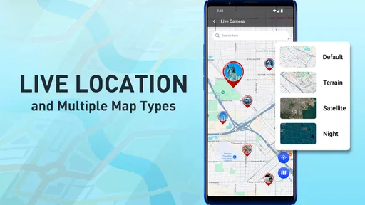
Another standout feature is the map view, which visually plots out where your photos were taken. It’s a fantastic way to see your travels mapped out, especially if you’re a visual person like me. Plus, the app supports multiple languages, making it accessible to a global audience.
Performance and Usability
Let’s talk performance. The app runs seamlessly without any noticeable lag. Even when snapping photos in quick succession, it keeps up, ensuring every image is stamped with the correct info. The accuracy of the GPS is impressive, and it doesn’t drain your battery as much as you might expect—always a plus when you’re out and about.
Usability-wise, the app is designed to be user-friendly. Whether you’re a tech-savvy individual or someone who just wants a simple tool to enhance your photo-taking experience, GPS Map Camera - Timestamp caters to all.
Where the handoff needs care
The map view is useful for reviewing a set of images as a route or collection of places, but it serves a different purpose from a shared photo album. I’d use it to retrace a day or find a location, then send selected pictures through the usual method for the recipient. The visible stamp travels with the image, while the map is most useful when I’m reviewing the captured set inside the app.
For work, I would keep the original files organized by visit or project as soon as I can. A stamped picture can show context at a glance, but it is not a substitute for a written report, a case number, or a clearly named folder when someone else has to find the evidence weeks later. If a photo may be used in a formal process, I’d also retain an unedited original and follow the organization’s own documentation rules.
How it compares with a regular camera
A phone’s standard camera is the more natural choice when I care mainly about image quality, familiar controls, or taking pictures quickly without a visible label. A separate editing app can add text afterward, but that means remembering to do it and matching each image with the right place and time. This app’s advantage is bringing those details into the capture workflow, not offering every tool a photographer might want.
That distinction makes it especially handy for field notes, travel records, and simple before-and-after documentation. It is less compelling for portraits, polished social posts, or situations where a clean frame matters most. I’d choose the ordinary camera for an image I want to edit creatively, and use GPS Map Camera when I know the context needs to stay attached and immediately visible.
Who will get the most from it
GPS Map Camera - Timestamp is a good fit for people who repeatedly ask themselves where or when a picture was taken: travelers, walkers, property visitors, and anyone keeping a visual log of places or tasks. It can also help when several similar-looking photos need to be sorted by location afterward. The benefit is not just remembering a trip; it is reducing the small bits of note-taking that otherwise get postponed and forgotten.
I’d skip it if I rarely need location context, dislike visible marks on photos, or already have a reliable system for recording the same details. It may also be the wrong choice when a location stamp would expose sensitive information, or when a strict professional workflow requires a particular camera, file format, or evidence-handling process. In those cases, the regular camera plus an approved logging method is safer.
Price, fit, and a sensible first test
The app is free to install, with in-app purchases ranging from $1.99 to $19.99 per item. I’d try the basic workflow before paying for anything: capture a sample, inspect the stamp, and see whether the map view helps you find that image again. That small test answers the practical question better than a feature checklist: does it save you time in the kind of situation you actually face?
It is developed by Sliver AI Photo Editor, and the photography app has a 4.6 average from around 1.4 thousand ratings, with over 5 million installs. It is rated for Everyone, and version 1.1.0 supports Android 7.0 and up. Those details make it easy to assess whether it fits your device and comfort level, but the real deciding factor is whether you want location and time information visibly attached to the picture.
Why You Need This App
We’ve all been there—scrolling through our camera roll trying to recall exactly where we captured that stunning sunset or quirky street art. GPS Map Camera - Timestamp solves this dilemma by embedding location, date, and time information directly onto your photos. It’s like having a personal travel diary, minus the hassle of jotting down every detail.
Getting Started: Easy Peasy
First things first, downloading and setting up the app is a breeze. Available on both Android and iOS, you can find it on the Google Play Store or the App Store. Once installed, the user interface is intuitive, so you won’t be fumbling around trying to figure out how to get started. Just open the app, and you’re greeted with a straightforward layout, ready for action.
After granting the necessary permissions—because, yes, it needs access to your camera and location—the app is all set to accompany you on your photographic journeys. It’s like having a reliable co-pilot who keeps track of all the details without any nagging.
The Nitty-Gritty: Features Galore
One of my favorite features is the customizable watermark. You can choose what details to display on your photos. Want just the location? Done. Prefer to include the date and time? No problem. The app lets you tailor the information to suit your needs, so you can keep it simple or go all out with the details.
Another standout feature is the map view, which visually plots out where your photos were taken. It’s a fantastic way to see your travels mapped out, especially if you’re a visual person like me. Plus, the app supports multiple languages, making it accessible to a global audience.
Performance and Usability
Let’s talk performance. The app runs seamlessly without any noticeable lag. Even when snapping photos in quick succession, it keeps up, ensuring every image is stamped with the correct info. The accuracy of the GPS is impressive, and it doesn’t drain your battery as much as you might expect—always a plus when you’re out and about.
Usability-wise, the app is designed to be user-friendly. Whether you’re a tech-savvy individual or someone who just wants a simple tool to enhance your photo-taking experience, GPS Map Camera - Timestamp caters to all.
When It Comes in Handy
This app is not just for travel buffs. Imagine you’re a real estate agent documenting property visits, a journalist covering stories, or even a nature enthusiast tracking wildlife. The ability to timestamp and geotag photos can be incredibly beneficial across various fields. It adds a layer of authenticity and detail to your images, which can be invaluable in many professional and personal scenarios.
Final Thoughts: A Must-Have Tool
In a world where visuals are paramount, GPS Map Camera - Timestamp is a tool that enhances the storytelling aspect of your images. It adds context and precision without any extra effort on your part. Whether you’re capturing memories on a cross-country road trip or documenting important work-related details, this app ensures you’ve got all the data you need right on your photos.
So next time you’re off on an adventure—or just going about your daily routine—consider giving this app a spin. It’s like adding a personal touch of magic to your photography, keeping every memory vivid and detailed. Happy snapping!
Pros
- Easy to use interface for quick navigation.
- Accurate timestamps for location tracking.
- Customizable watermark options.
- Supports multiple languages.
- Integrates seamlessly with other apps.
Cons
- Frequent ads can disrupt usage.
- Limited offline functionality.
- Some features require in-app purchases.
- Occasional GPS signal drop.
- Battery consumption is relatively high.
FAQs for GPS Map Camera - Timestamp
What is GPS Map Camera - Timestamp and how does it work?
GPS Map Camera - Timestamp is an app designed to enhance your photography by embedding location data and timestamps directly onto your photos. It uses your device’s GPS to accurately capture your current location and overlays this information onto the image, making it ideal for travel documentation and fieldwork.
Can I customize the information displayed on my photos?
Yes, GPS Map Camera - Timestamp allows you to customize the information displayed. You can choose from various stamp templates, adjust the font size and color, and decide whether to include details like altitude, weather, and address, making it versatile for personal and professional use.
Is GPS Map Camera - Timestamp available for both Android and iOS?
The app is available for both Android and iOS platforms. You can download it from the Google Play Store for Android devices and the Apple App Store for iOS devices. Ensure you have a stable internet connection for the download and installation process.
Does the app work offline, or do I need an internet connection?
GPS Map Camera - Timestamp primarily requires GPS to function, which can work offline. However, certain features, such as retrieving detailed address information or weather conditions, may require an internet connection to access online databases.
Is my data safe while using GPS Map Camera - Timestamp?
Your data privacy is a priority. The app does not store or share your location data without your permission. It strictly uses the data to enhance the photo experience on your device, ensuring your information remains secure and private.


